October 26, 2016
SVSU student wins first place for presentation on Kawkawlin River research
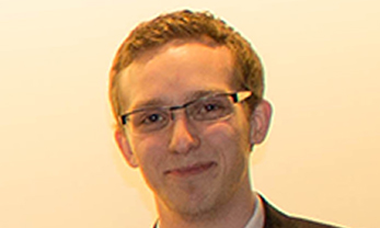
 Saginaw Valley State University student Erik Breidinger recently earned top honors for presenting his community-minded research on the Kawkawlin River. A communication and geography double major from Auburn, he won first place in the undergraduate paper presentation category at the American Association of Geographers East Lakes/West Lakes conference Friday, Oct. 14 at Northern Michigan University.
Breidinger presented his paper titled “Mapping land cover changes along the Kawkawlin River using object-based classification of 1938 and 2014 aerial photography.” Marty Arford, SVSU associate professor of geography, and Rhett Mohler, SVSU assistant professor of geography, traveled with him for the conference and have provided research guidance.
To conduct the necessary research addressed in the paper, Breidinger and Mohler used eCognition Developer software that employed remote sensing to gather imagery to study Earth's surface.
“It looks at how we've used the land, and how that's changed from 1938 to 2014,” Breidinger said, “using a combination of really old paper photographs and new, really high tech satellite imagery, and how we merged those together to make a map where you can instantly tell what's changed and what hasn't.”
The 15-minute presentation was followed by a question and answer session at the conference.
“The Q and A was really helpful because I'm an undergraduate, and everybody else at these conferences are usually master’s or Ph.D. students,” Breidinger said. “They always have really good questions and they kind of suggest places for me to go with the research.”
Breidinger’s research was supported through SVSU’s Saginaw Bay Environmental Science Institute and the SVSU Foundation Resource Grant program. The grants allowed Breidinger and Mohler to purchase the software package, giving SVSU students unlimited access for research purposes.
Previously, the geography department only had access to tools that broke images down into pixel. From there, they would have had to compare the pixel colors to differentiate what has changed over time from what has not. Breidinger explained that this analysis method would have made the incorporation of old black and white photography very difficult.
The new software uses a program “that doesn't rely on pixels, but breaks images into objects. So now, we can say this polygon got bigger or changed in shape,” Breidinger explained.
Following his regional honor, Breidinger will present his research paper at the national level in Boston next April. There, all winning projects from the regional competitions will congregate. Breidinger and Mohler attended the national conference last year as well, which took place in San Francisco.
Mohler, the professor, said “ the end result of this project was to create land cover maps of the Kawkawlin River watershed, and to prove that eCognition software would be able to classify land cover types in older, 1930s black and white aerial photography. Both goals were accomplished.”
Breidinger has a few more semesters to complete at SVSU. During that time, he plans to remain actively involved in research within the geography department as well as competing for SVSU’s forensics team, which he credits for much of his love for public speaking. The forensics team, advised by Amy Pierce, associate professor of communications at SVSU, competes in both state and national tournaments. Breidinger has been successful in that competition circuit too, earning several first-place finishes.
